You are presumed to be honest and responsible without evidence to the contrary beyond a reasonable doubt… on the balance of probablilties you are justified by 51 % likelyhood.
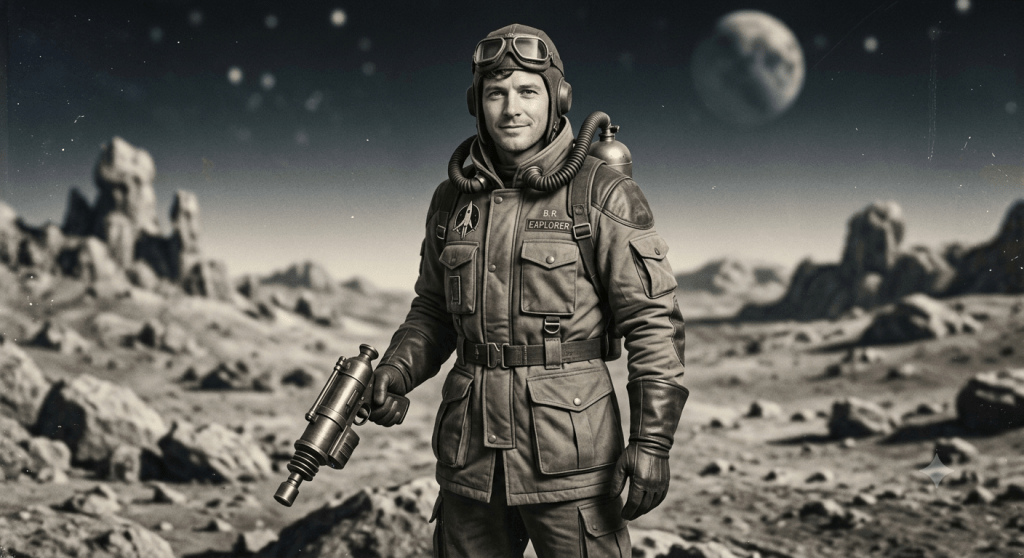
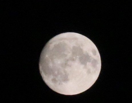
The Genesis of this may have come from character from comic books nearly a century ago, he was called Buck Rogers, January 7th 2029 first comic strip published.
So, the smoke tariff is a thing of the past, as we go into August 2026. But here’s an idea, create a narrative in your garden over August before you harvest in September with garden totems. Tell the the story in gli🌨️phs of nick nacs and surviving images that may have perished except for your pluck and presence.
So, enduring…
Happy day on your way…
Editor’s: Note Smoke is back going into the weekend…
Viewing wild orcas in British Columbia is a world-class experience. The coastal waters surrounding Vancouver Island and the BC mainland provide some of the richest marine habitats on Earth, attracting two primary distinct populations (ecotypes) of orcas. ### **1. Key Orca Ecotypes in BC** * **Bigg’s (Transient) Orcas:** These are mammal-eating orcas that hunt seals, sea lions, and porpoises. Their populations are thriving along the BC coast, and they move continuously throughout the Salish Sea and outer coastal inlets, making year-round sightings frequent. * **Resident Orcas (Northern & Southern):** These orcas feed almost exclusively on fish, especially Chinook salmon. * **Northern Residents:** Frequently sighted in the waters around Northern Vancouver Island (Johnstone Strait and Broughton Archipelago) during summer and early fall. * **Southern Residents:** Found around southern Vancouver Island, the Gulf Islands, and the Salish Sea. Due to conservation efforts, strict distance regulations apply when viewing them to protect their population. ### **2. Top Locations for Orca Viewing** #### **Telegraph Cove & Johnstone Strait (Northeast Vancouver Island)** * **Highlights:** Widely recognized as one of the best locations in the world for orca watching. Home to the **Robson Bight (Michael Bigg) Ecological Reserve**, a protected sanctuary famous for its “rubbing beaches,” where Northern Resident orcas come to rub against smooth gravel on the ocean floor. * **How to Experience:** Boat tours, multi-day sea kayaking expeditions, or zodiac excursions based out of Telegraph Cove, Port McNeill, or Alert Bay. #### **Victoria & Sooke (Southern Vancouver Island)** * **Highlights:** Prime entry point to the Salish Sea and Strait of Juan de Fuca. Excellent for spotting Bigg’s orcas and humpback whales. * **How to Experience:** Daily Zodiac and covered cruiser tours depart directly from Victoria’s Inner Harbour or Sooke. #### **Vancouver & Steveston (Lower Mainland)** * **Highlights:** Convenient access for travelers staying on the mainland. Tours navigate the Strait of Georgia, the Gulf Islands, and Howe Sound to follow active pods. * **How to Experience:** Day-trip operators depart out of Granville Island, Coal Harbour, and Steveston Village (Richmond). #### **Campbell River & Cowichan Bay / Parksville (Central Salish Sea)** * **Highlights:** Sheltered waters between Vancouver Island and the mainland, offering high success rates for spotting transient pods navigating channel passes. #### **Prince Rupert & The North Coast** * **Highlights:** For a remote, off-the-beaten-path experience, northern BC waters offer encounters with migrating orcas following salmon runs alongside humpbacks and grizzly bear viewing. ### **3. Prime Season** * **Best Months:** **May through October** * **July to September** is peak season, offering calm sea conditions, long daylight hours, and high concentrations of both resident and transient orcas following migrating salmon or hunting marine mammals. * **Year-Round Potential:** Because Bigg’s (transient) orcas travel constantly in search of seals and sea lions, they can be spotted in BC waters in winter and spring as well. ### **4. Ways to Tour** * **Covered Motor Vessels / Cruisers:** Ideal for family comfort, shelter from wind and spray, photography with stable platforms, and onboard naturalists. * **Zodiacs:** Open-air, high-speed boats that offer an adventurous, closer-to-the-water feel. * **Guided Kayaking Trips:** Multi-day basecamp or expedition tours (especially in Johnstone Strait / Hanson Island) allow quiet, immersive encounters with wildlife.
### **5. Responsible Viewing Guidelines**
When orcas feed they are very robust at acrobatics from the distance it can be thrilling, stay safe, don’t Harrah’s the animals…
* **Distance Laws:** Marine mammal regulations in Canada require vessels to maintain a minimum distance (typically **400 metres** for all killer whales in BC coastal waters, or **200 metres** in specific designated areas for non-resident populations) to prevent boat noise from interfering with their echolocation and feeding. * **Eco-Certified Operators:** Choose operators accredited by the *Pacific Whale Watching Association (PWWA)* or local eco-tourism boards that follow strict wildlife viewing protocols and contribute to marine conservation research.
Pacific Wale Watching Assocation
This is an international association members are linked below. We suggest to be safe to engage the people that have the cumulative experience to ensure your safety.
While some interactions can naturally happen closely, there are strict guidelines in place today to ensure the animals are protected and not disturbed.
To understand Tarot, it helps to start with what it physically is: a standardized deck of 78 cards featuring symbolic imagery. Originally created in 15th-century Northern Italy, Tarot began not as a mystical tool, but as a parlor game for wealthy nobles called *Tarocchi* (similar to modern bridge). It wasn’t until the late 18th century that French occultists reinterpreted the vivid, allegorical pictures as a tool for divination and introspective reflection. Here is how Tarot aligns with the categories you asked about:
## 1. Is it a Religion?
**No.** Tarot has no dogma, central deity, scriptures, or required system of worship. People of virtually any religious background—or none at all—use Tarot. While some modern pagan, Wiccan, or esoteric spiritual practices incorporate the cards into their rituals, the deck itself is simply a medium, much like a journal or an art collection.
## 2. Is it a Discipline?
**Yes, in a practical and psychological sense.** Learning Tarot requires study and structured practice. A reader must memorize the foundational meanings of all 78 cards (split into the 22 “Major Arcana” representing big life lessons, and 56 “Minor Arcana” dealing with daily events) and learn how various visual motifs interact. In modern psychology—starting with Carl Jung—Tarot is studied as a **system of archetypes**. Many readers use it non-mystically as a introspective tool. Because the cards represent universal human experiences (grief, transition, ambition, balance), looking at a random card prompt can help a person organize their thoughts, mirror their subconscious feelings, or view a problem from a new perspective.
## 3. Is it a Superstition?
**It depends on how it is used.** * **If used for fortune-telling:** If someone believes the cards hold supernatural power to predict precise, literal future events (e.g., “This card proves you will win the lottery on Tuesday”), mainstream science and logic treat that as a superstition. The physical order of a shuffled deck is purely random. * **If used for reflection:** If viewed instead as a set of visual storytelling prompts to trigger self-reflection, there is no superstition involved—just visual metaphor and creative interpretation.
## 4. Does it have Astronomical / Professional Value?
**In terms of modern astronomy, no.** Tarot has no scientific or observational value for studying outer space, celestial mechanics, or physical star movements. Astronomy is an empirical science; Tarot is symbolic art.
**However, there is a historical connection to Astrology:**
In the late 19th and early 20th centuries, occult societies (like the Hermetic Order of the Golden Dawn) mapped standard astrological symbols—such as the 12 zodiac signs and classical planets—onto individual Tarot cards.
While astronomers do not recognize these connections, historians, art scholars, and professional mythologists study Tarot for its rich iconographic history and cultural impact across Europe over the last 500 years.
British Columbia Sites worthy. 10 sites worth your time…
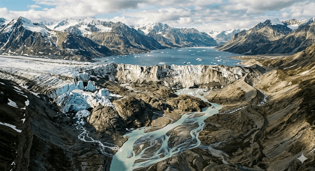
British Columbia offers a vast canvas for landscape and outdoor photography, ranging from rugged coastal rainforests to dry interior canyons and dramatic alpine peaks. Here are **10 of the most visually spectacular sites in BC**, selected for their distinct geological character, compelling natural light, and immense creative potential: ### **1. Mount Robson Provincial Park (Berg Lake & Kinney Lake)** * **The Draw:** Home to the highest peak in the Canadian Rockies. The sheer vertical scale of Mount Robson rising above glacier-fed water provides incredible depth and dramatic contrast. * **Photographic Focus:** Capturing early morning light hit the face of Mt. Robson, or framing the vivid turquoise waters of Kinney Lake against surrounding alpine slopes. ### **2. Mount Assiniboine Provincial Park** * **The Draw:** Often dubbed the “Matterhorn of the Rockies,” this remote park is a dream for wide-angle landscape photography featuring jagged peaks, larch forests, and crystal-clear reflection lakes. * **Photographic Focus:** Sunrises over Sunburst Lake with Mt. Assiniboine perfectly mirrored on a calm morning. ### **3. Yoho National Park (Emerald Lake & Lake O’Hara)** * **The Draw:** Tucked along the continental divide, Yoho features intense glacial silts, towering waterfalls (like Takakkaw Falls), and rugged granite amphitheaters. * **Photographic Focus:** Reflections of surrounding peaks on the still surface of Emerald Lake or framing dramatic, cascading water against deep canyon walls. ### **4. Pacific Rim National Park Reserve (Tofino & Ucluelet)** * **The Draw:** Wild, moody Pacific Northwest coastline. Mist-shrouded old-growth rainforests meet rocky headlands and expansive, ocean-swept beaches. * **Photographic Focus:** Long-exposure seascape photography along Chesterman Beach or the Wild Pacific Trail during stormy weather, capturing churning waves and sea stacks. ### **5. Joffre Lakes Provincial Park** * **The Draw:** Three cascading alpine lakes famous for their striking, radiant turquoise color caused by glacial flour suspended in the water. * **Photographic Focus:** Framing the Matier Glacier hovering over Middle and Upper Joffre Lakes using shoreline logs or pine branches for strong foreground leading lines. ### **6. Seton Lake & The Fraser Canyon (Lillooet Region)** * **The Draw:** A unique contrast to coastal rainforests, this dry interior landscape features sharp canyon walls, winding rivers, and brilliant golden hour light. * **Photographic Focus:** The dramatic horseshoe bend of the lake framed by arid, rugged mountains during sunset, highlighting texture and warm earth tones. ### **7. Great Bear Rainforest & Bella Coola Valley** * **The Draw:** One of the most pristine coastal temperate rainforests left on Earth, where deep fjords meet steep, glacier-capped mountains and ancient granite walls. * **Photographic Focus:** Atmospheric, moody forest framing, ocean mist hanging over narrow inlets, and dynamic wildlife photography along river valleys. ### **8. Wells Gray Provincial Park** * **The Draw:** Known as Canada’s “waterfall park,” shaped by ancient volcanic activity and glacial carving. It features massive drops like Helmcken Falls plunging into deep canyons. * **Photographic Focus:** Experimenting with shutter speeds to capture the sheer power and movement of Helmcken, Dawson, or Moul Falls framed by volcanic rock walls. ### **9. Kootenay Lake & West Kootenay Passes** * **The Draw:** Deep, fjord-like lake basins surrounded by the Selkirk and Purcell Mountain ranges. The area mixes quiet historic charm with dramatic valley elevation shifts. * **Photographic Focus:** Composition opportunities using ferry crossings, shoreline reflections, and mountain passes catching low-angle alpine light during golden hour or twilight. ### **10. Johnstone Strait & Telegraph Cove (Northern Vancouver Island)** * **The Draw:** Misty marine channels, lush coastal islands, and rich ocean ecosystems. * **Photographic Focus:** Telephoto compositions capturing marine life against mist-laden forest backdrops, or framing colorful boardwalk settlements tucked into coastal bays.
From the Editor:
Under the government’s Canada strong initiative:. Admission in national parks is free till September 7th 2026. Some provincial parks are also sharing in this initiative or their own.