
The Lower Mainland in British Columbia is a broad geographic and cultural region that typically includes the Metro Vancouver Regional District and the Fraser Valley Regional District, extending from Vancouver in the west to Hope in the east, and from the U.S. border to the south, up to Whistler and the Sunshine Coast in the north.
Here are many of the cities and municipalities you’ll find within this region:
Metro Vancouver Regional District:
* Vancouver
* Burnaby
* Richmond
* Surrey
* Coquitlam
* Delta
* Langley (City and Township)
* Maple Ridge
* New Westminster
* North Vancouver (City and District)
* Pitt Meadows
* Port Coquitlam
* Port Moody
* West Vancouver
* White Rock
* Anmore (village)
* Belcarra (village)
* Bowen Island (island municipality)
* Lions Bay (village)
Fraser Valley Regional District (often considered part of the broader Lower Mainland):
* Abbotsford
* Chilliwack
* Mission
* Hope
* Kent (includes Agassiz)
It’s worth noting that the exact definition of “Lower Mainland” can sometimes vary, but these are generally the key urban centers and municipalities within that area.

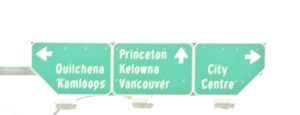
Highway access
Lower Mainland
Well a view of last fall in Merritt BC, In and around the art councils Gallery there. How are you for coming into the fall now, do you have some goals. Maybe participating in a gallery showing in Merritt BC in the South Central interior may have something to offer you. Go by the gallery and commit yourself for your fall coming up. Or a wonderful array of similar and related organizations just down the road
British Columbia lower mainland :
Highway 1 (Trans-Canada Highway)
Here is an interactive map detailing the layout of [Greater Vancouver](https://www.google.com/search?kgmid=/m/06_y0m_)
and the Lower Mainland, showcasing the primary transit corridors, cities, and critical highway junctions spanning southwestern British Columbia.[Rich media excluded from paste]## Major Corridor Reference## Highway
1 (Trans-Canada Highway)* * Willingdon Avenue (Exit 29):
Connects to Central Burnaby and Brentwood.* Brunette Avenue (Exit 40): Splits traffic toward New Westminster and Coquitlam.* 200 Street (Exit 58): The major artery connecting North and South Langley.* ## Highway 99——————————[Bridgeport Road* Route* Richmond, BC](https://www.google.com/search?kgmid=/g/1v75rlq7)Direct access into central Richmond and YVR.——————————[Ladner Trunk Road* Route* Delta, BC](https://www.google.com/search?kgmid=/g/1tfg2shj)Main access hub for Delta and Ladner, situated just south of the George Massey Tunnel.If you are planning a trip through the region, tell me your starting point, your destination, or if you need to locate a specific bridge or tunnel crossing to avoid traffic.



 Kevin Griffiths
 percypaschal
